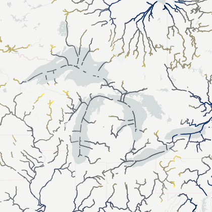
The Surface Water and Ocean Topography (SWOT) mission aims to provide valuable data and information about the world's oceans and its terrestrial surface water such as lakes, rivers, and wetlands. SWOT is being developed jointly by National Aeronautics and Space Administration (NASA) and Centre National D'Etudes Spatiales (CNES), with contributions from the Canadian Space Agency (CSA) and United Kingdom Space Agency (UKSA). SWOT successfully launched on December 16, 2022. Since then, over land, SWOT provides measurements of water storage changes (surface water area and water depth) of major lakes, reservoirs, rivers, and wetlands, and support derived estimates of river discharge, which aid in assessing water resources. SWOT observes rivers wider than 100 m and lakes with a surface area of 6,25 hectares or more (i.e., an outline of 250 m x 250 m).
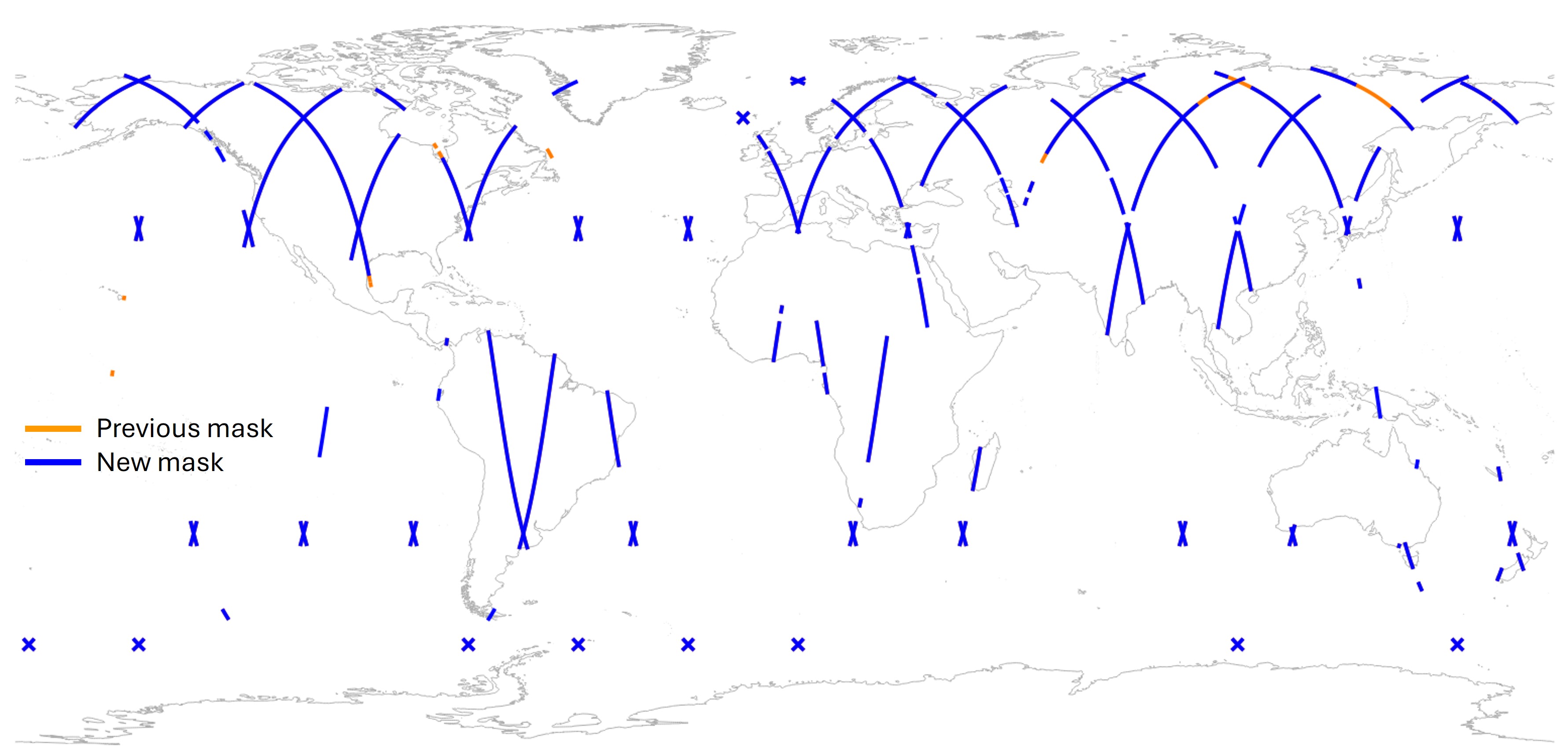
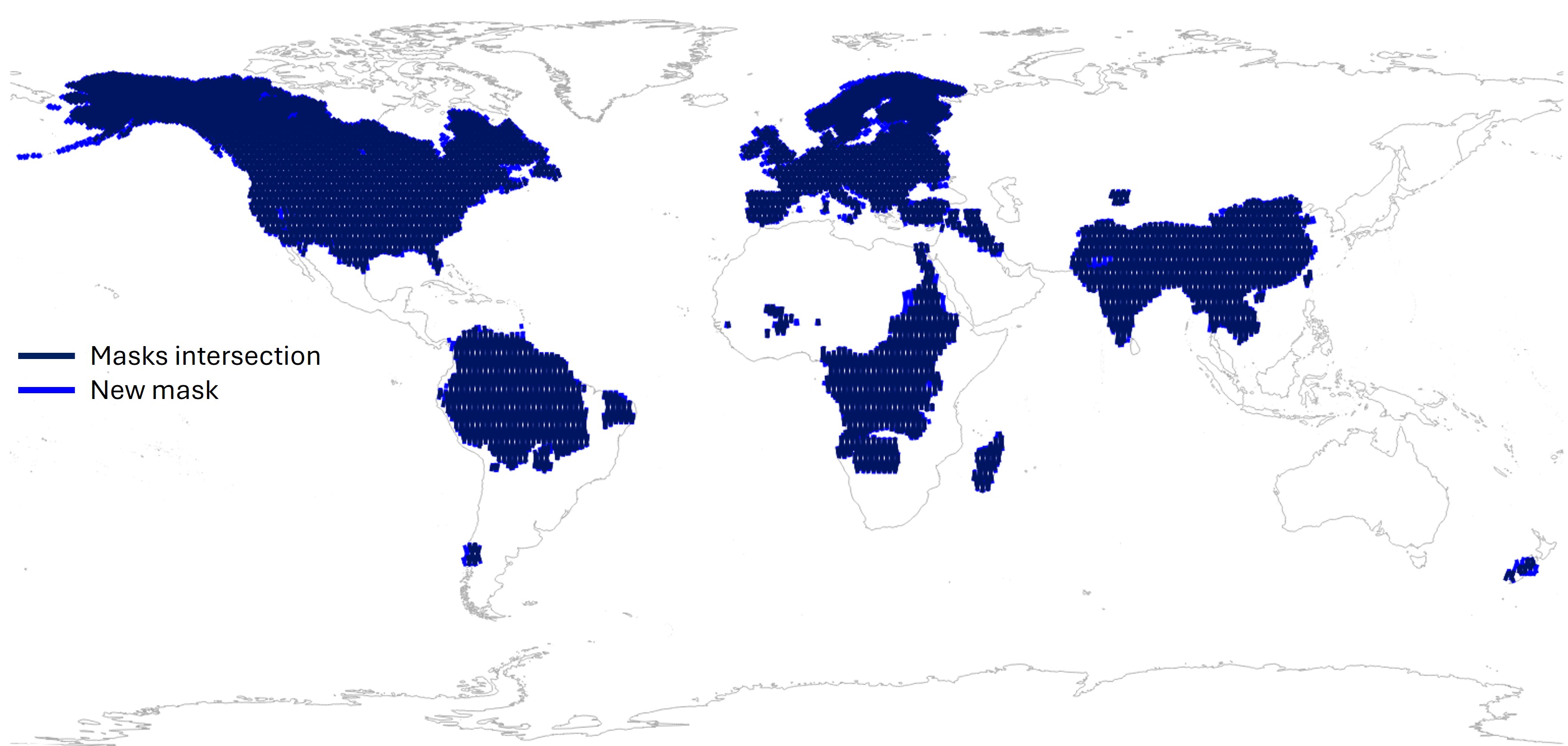
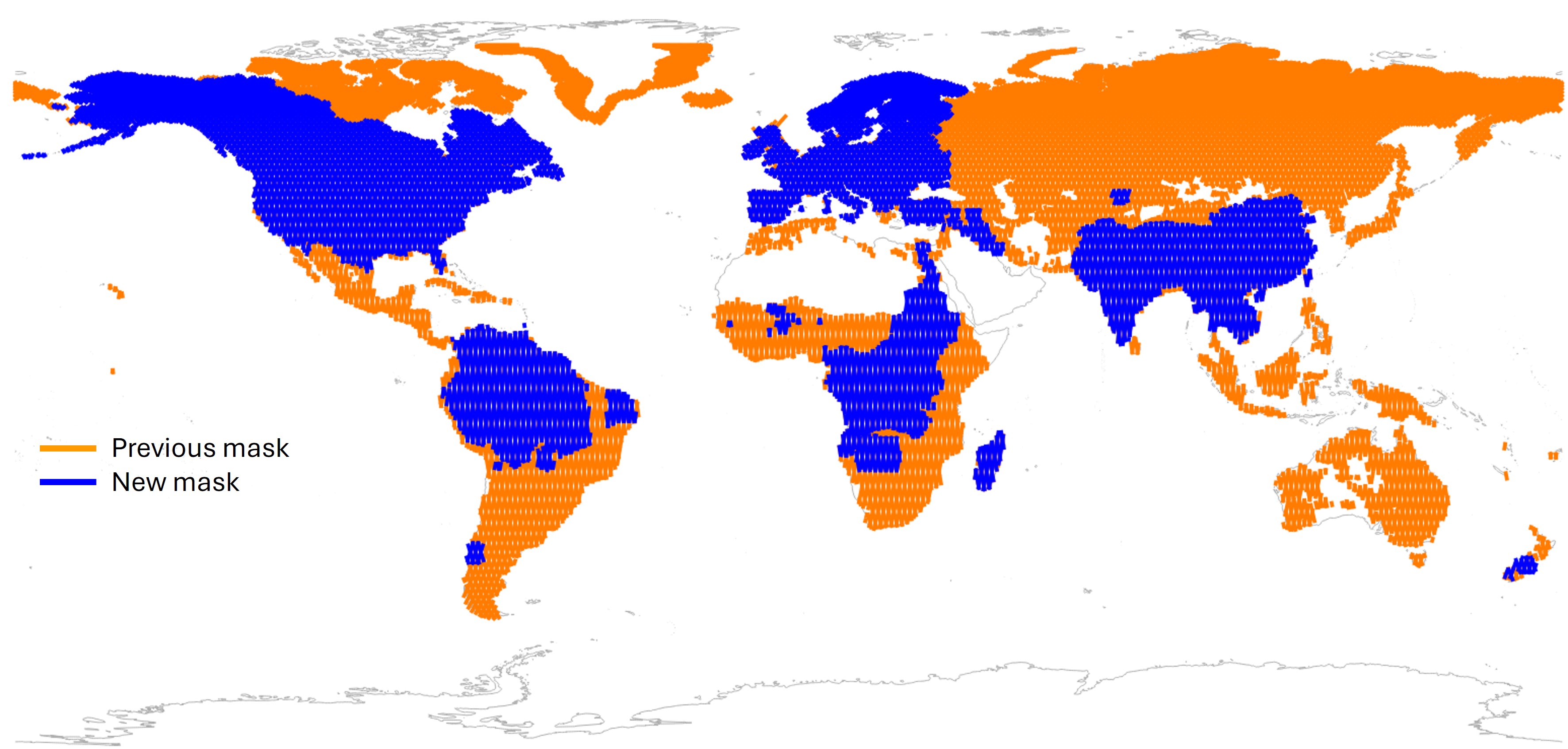
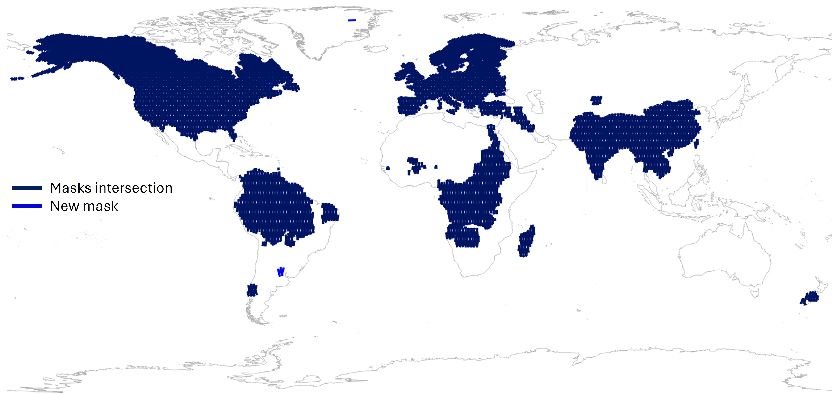
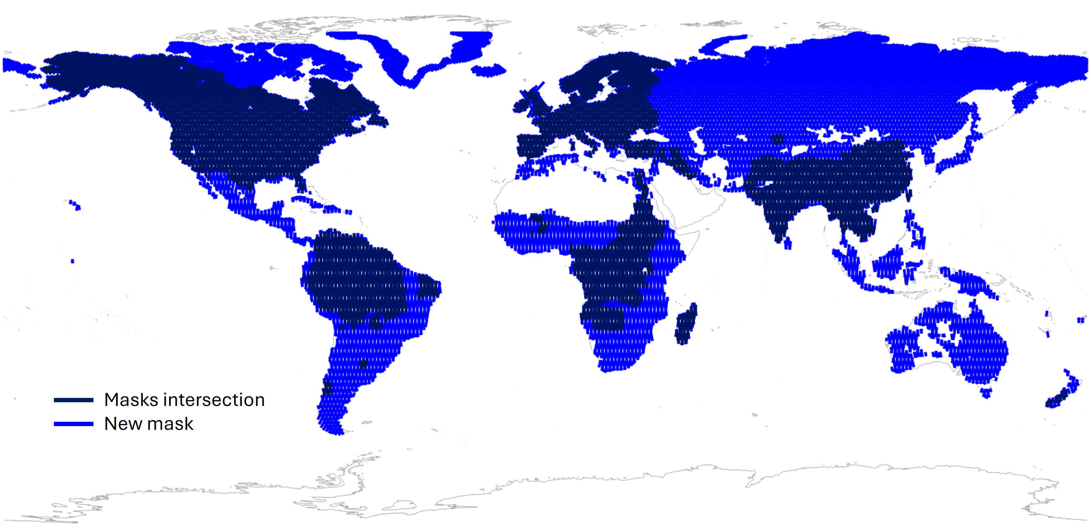
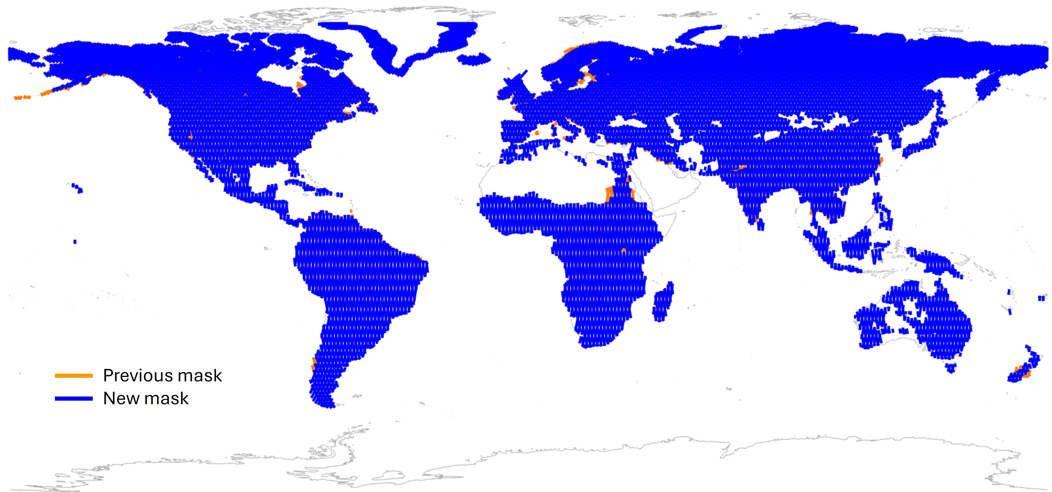
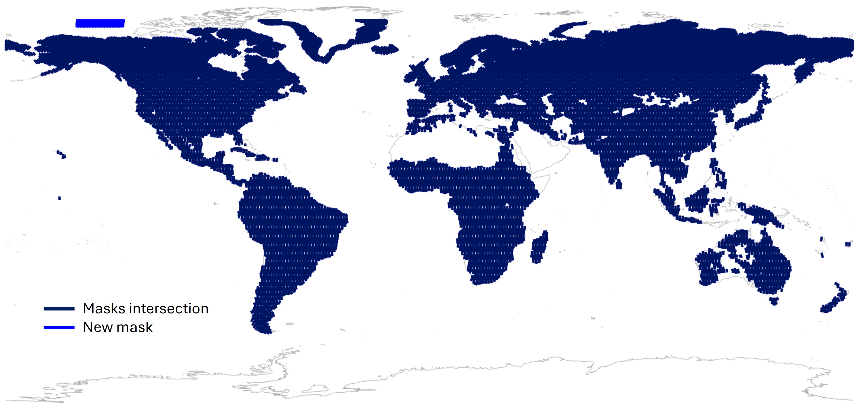
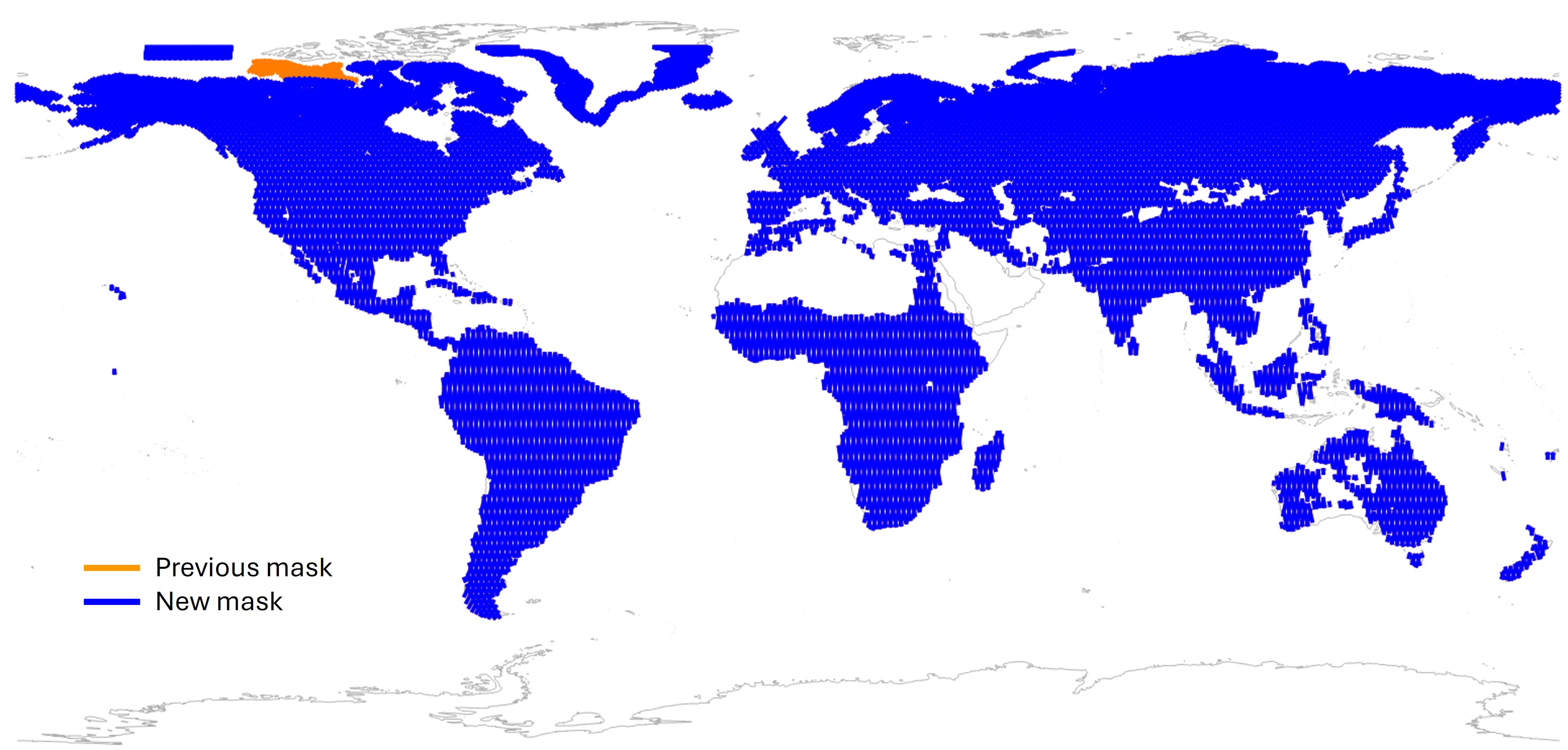
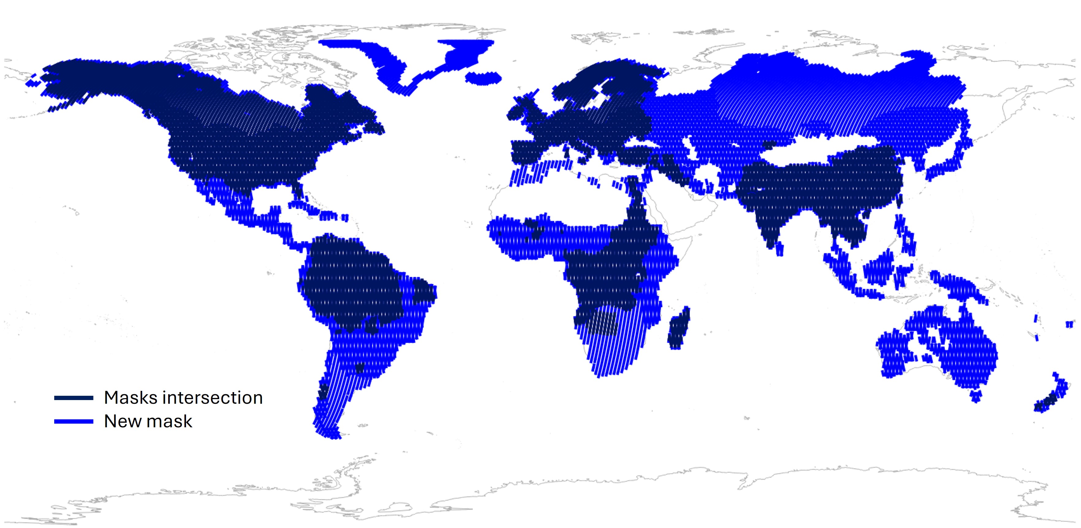
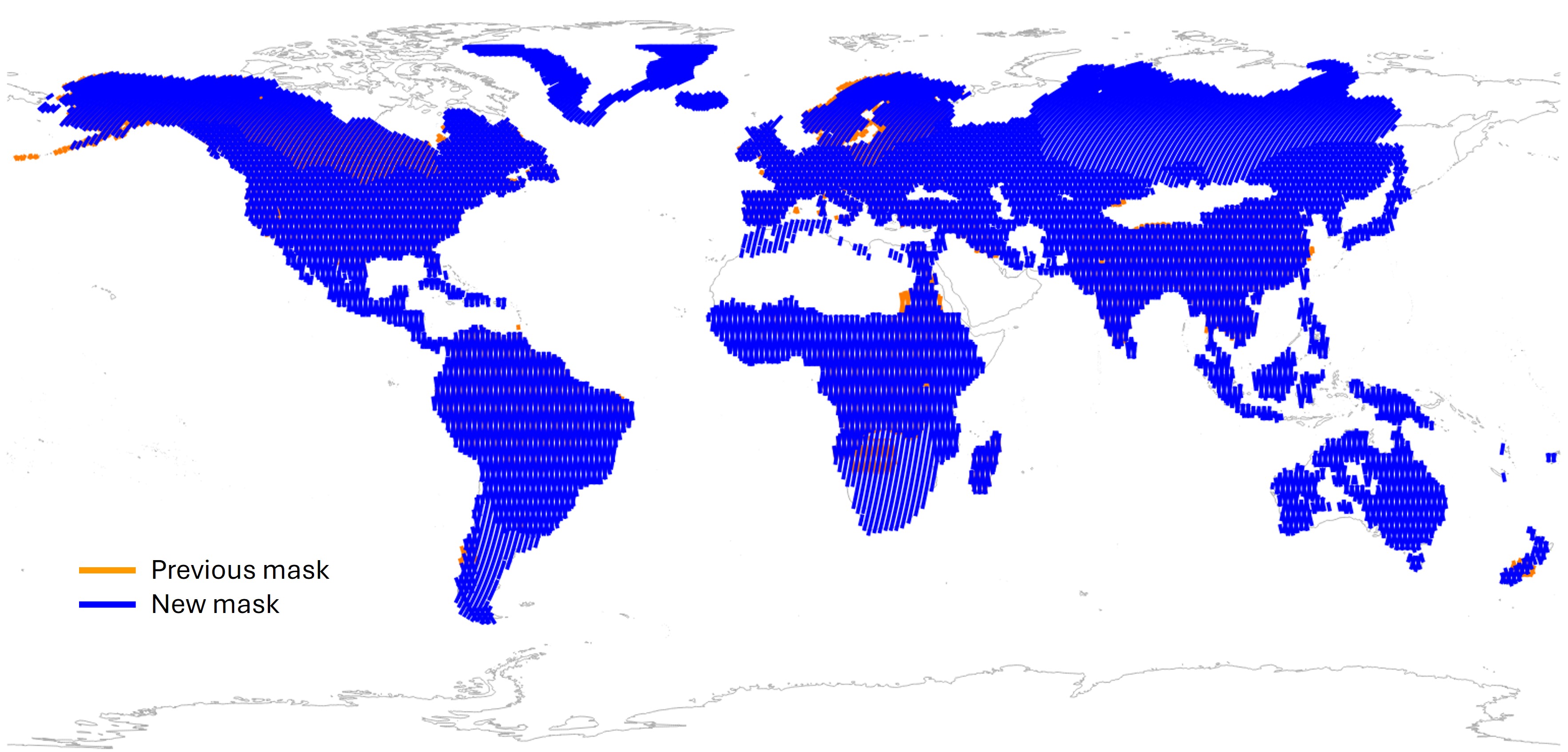
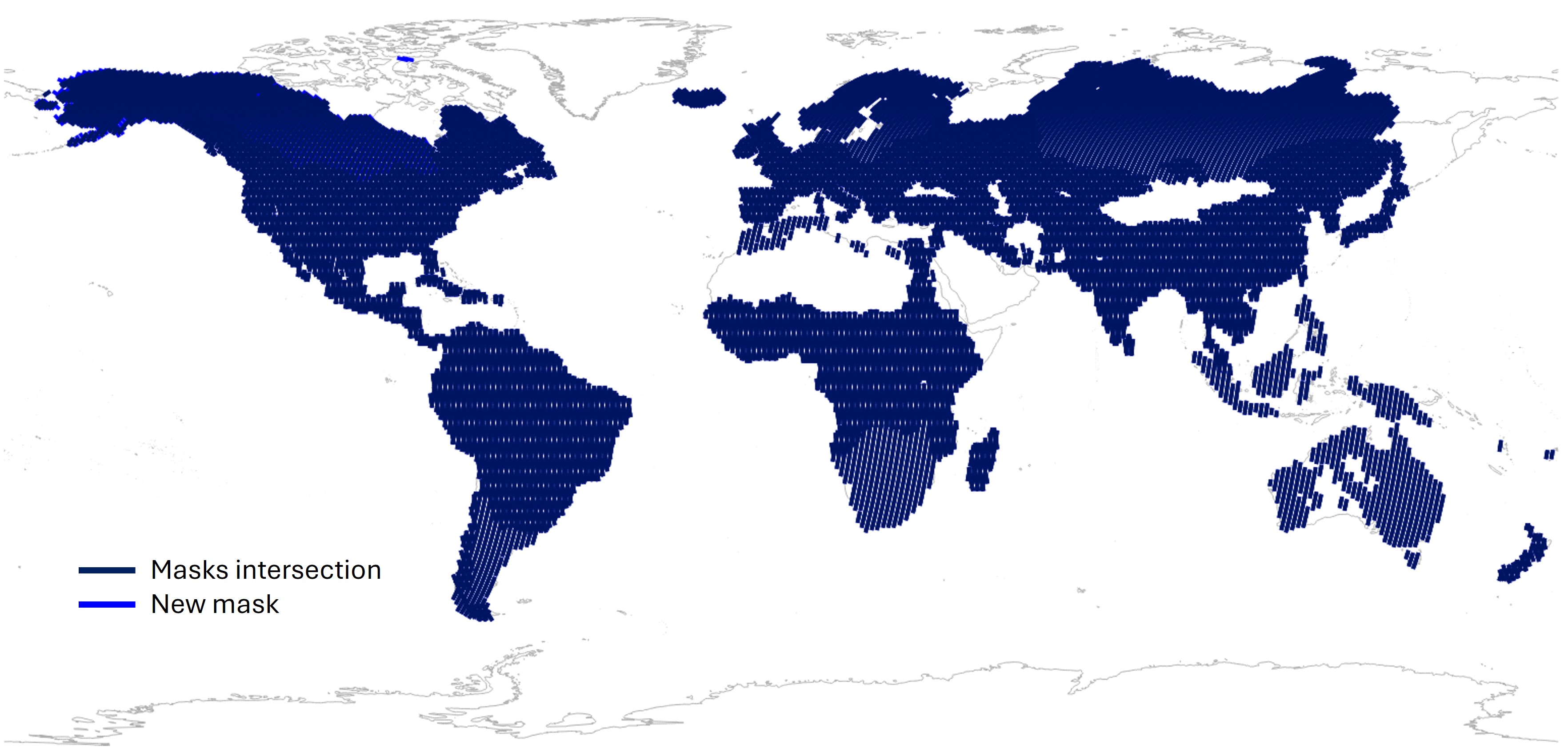
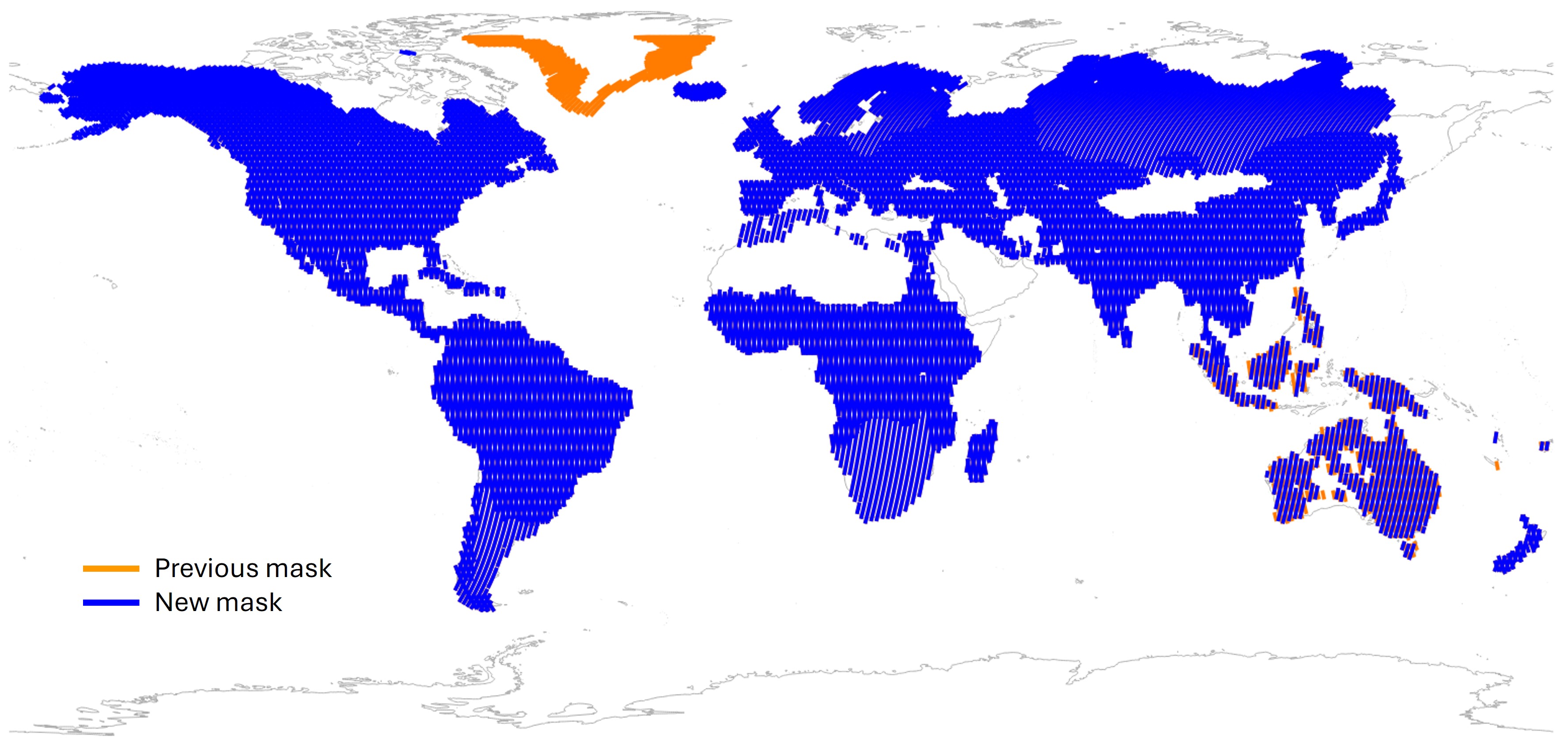
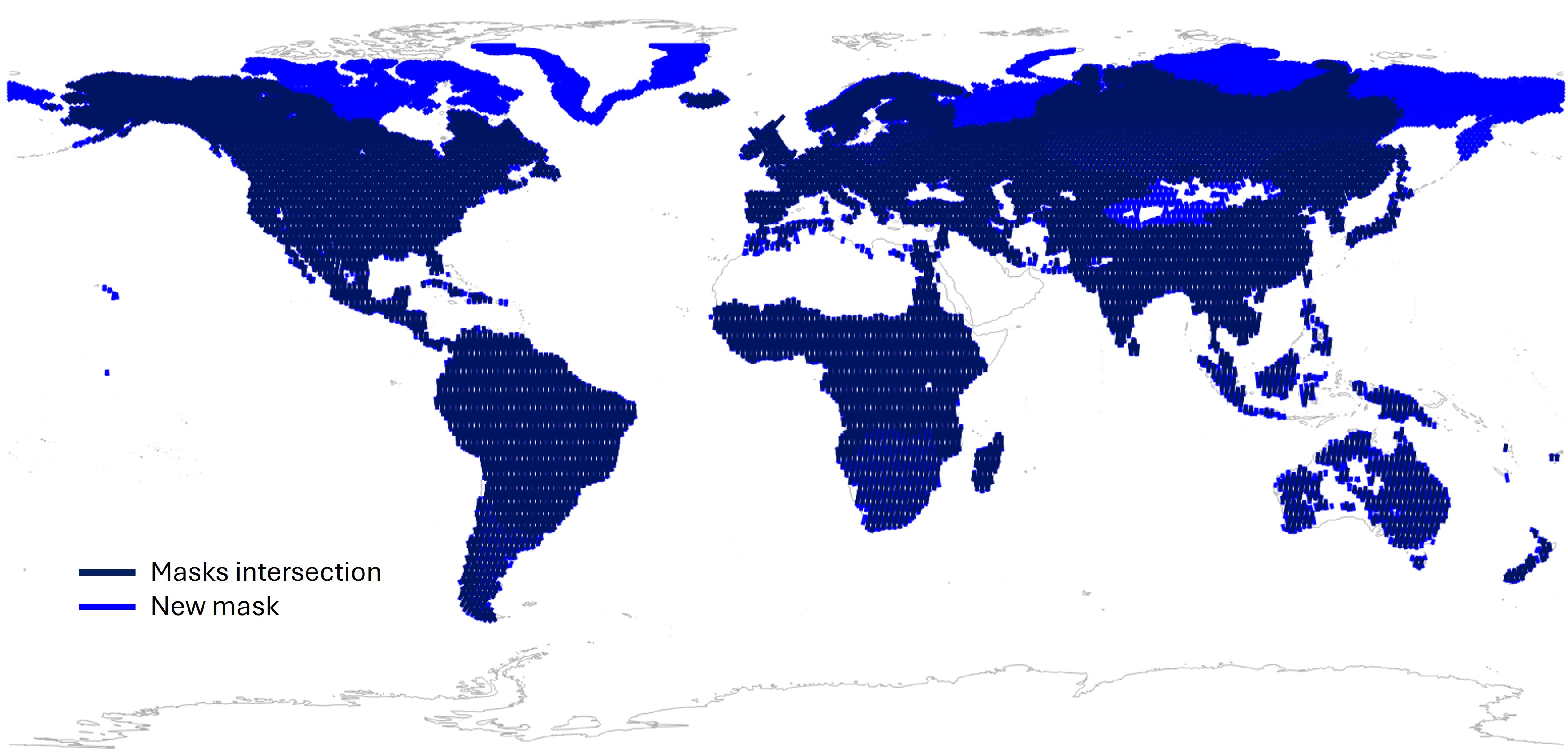
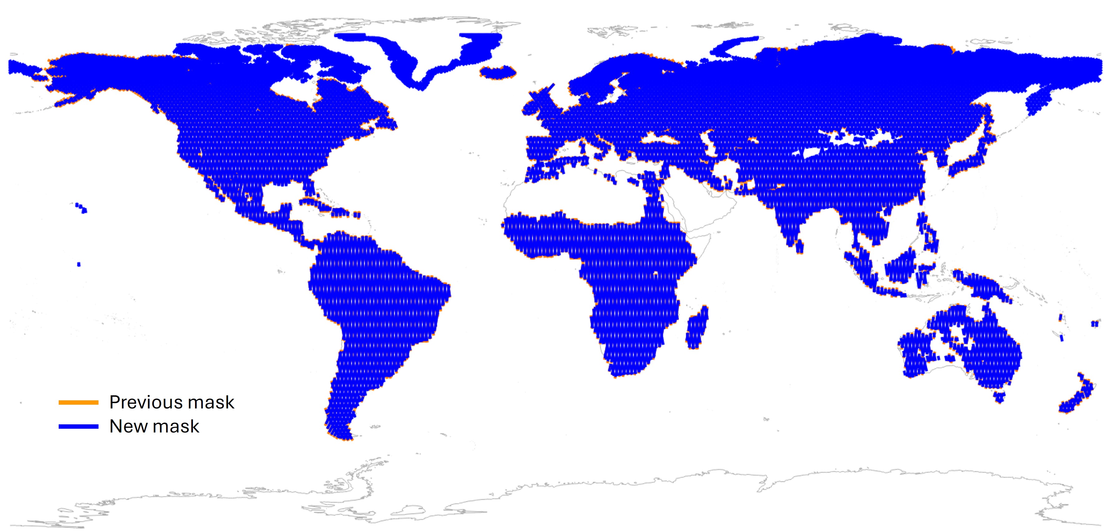
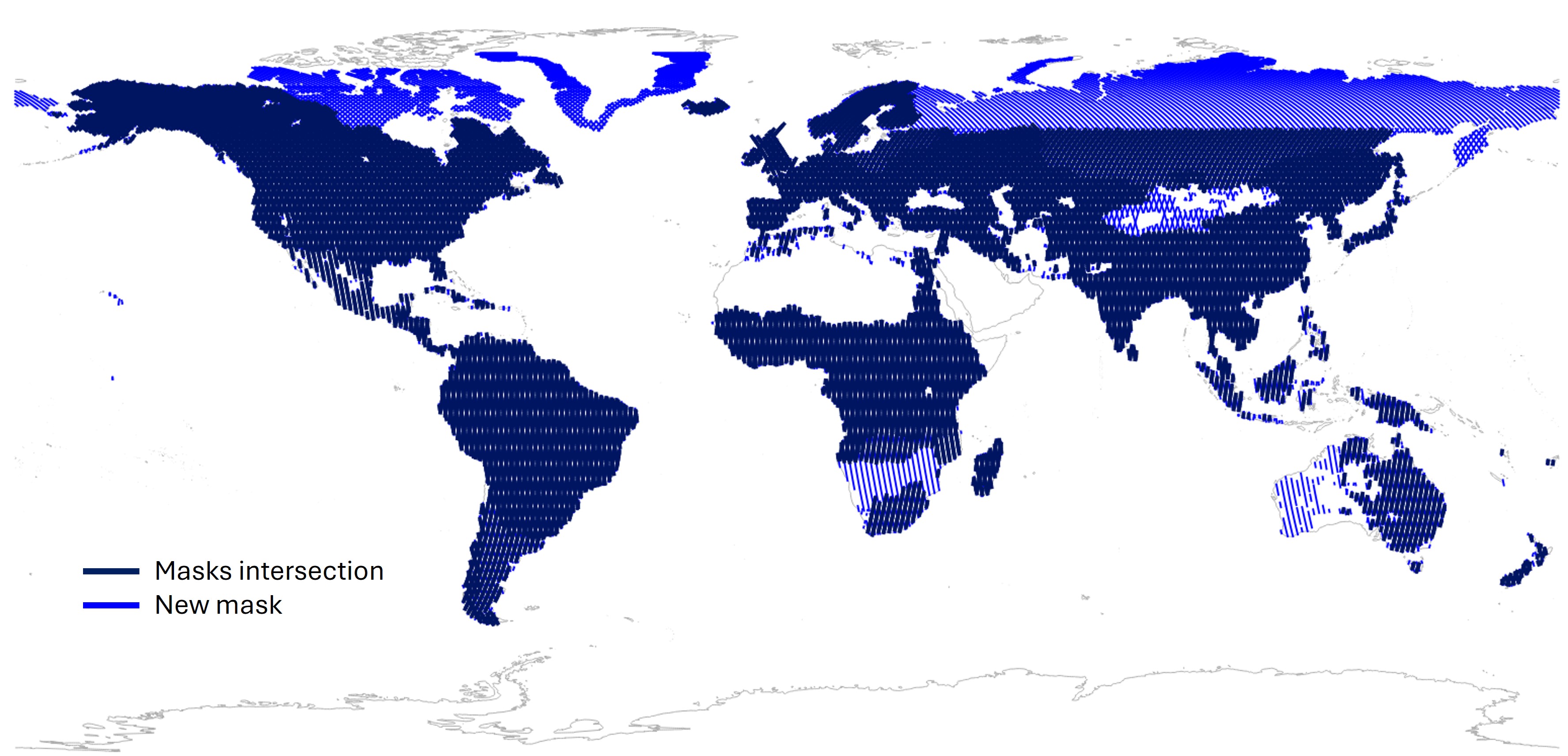
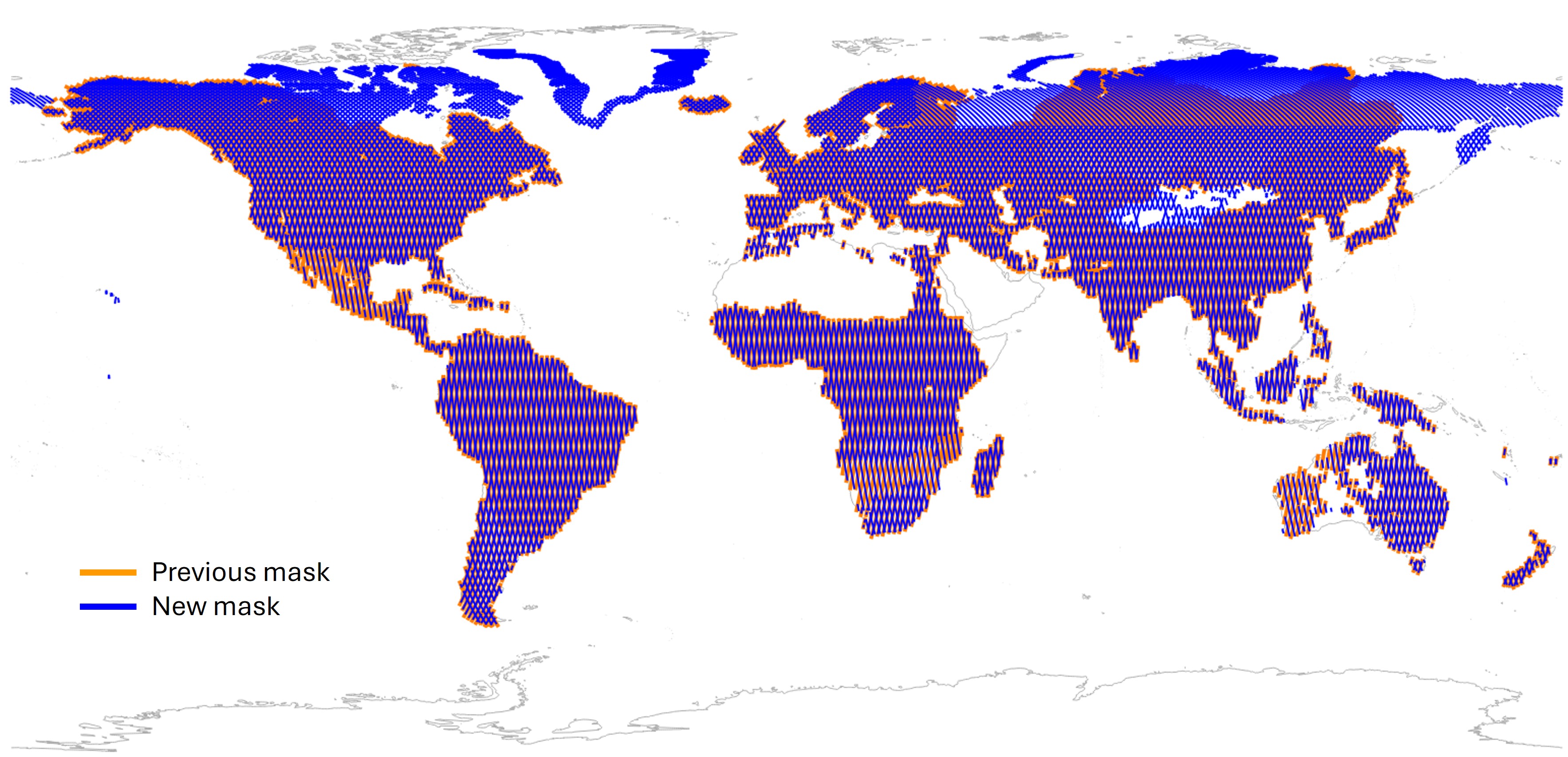
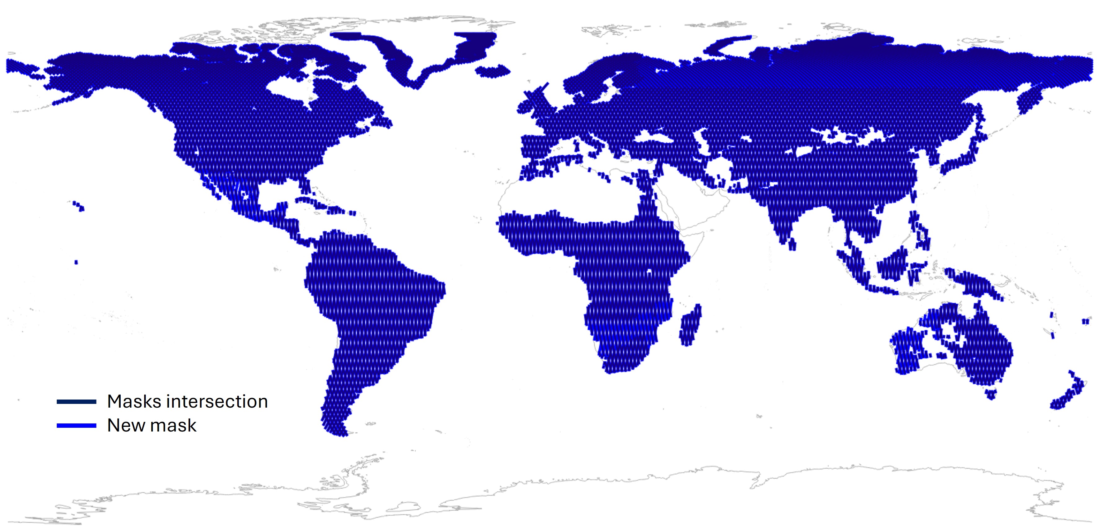
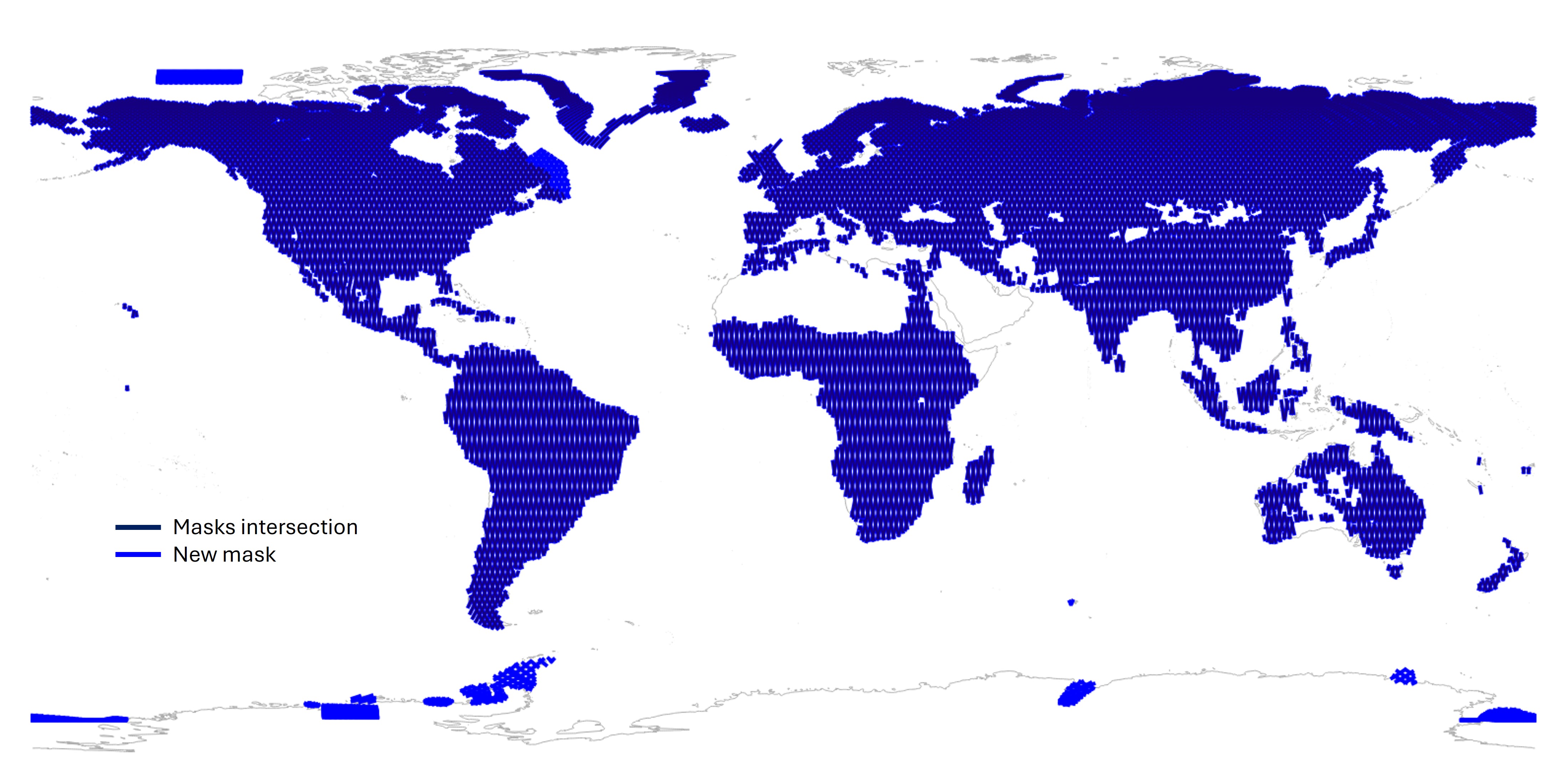
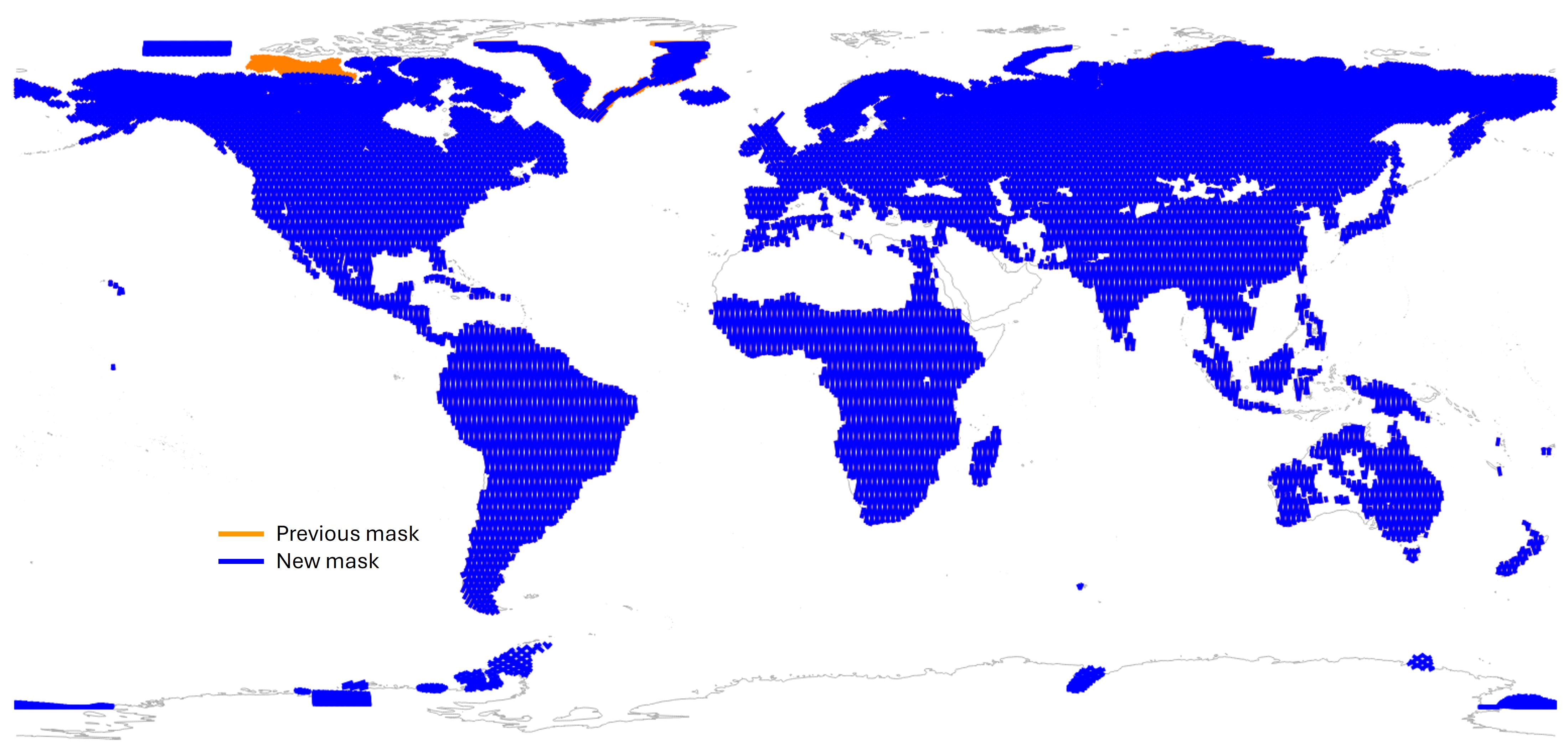
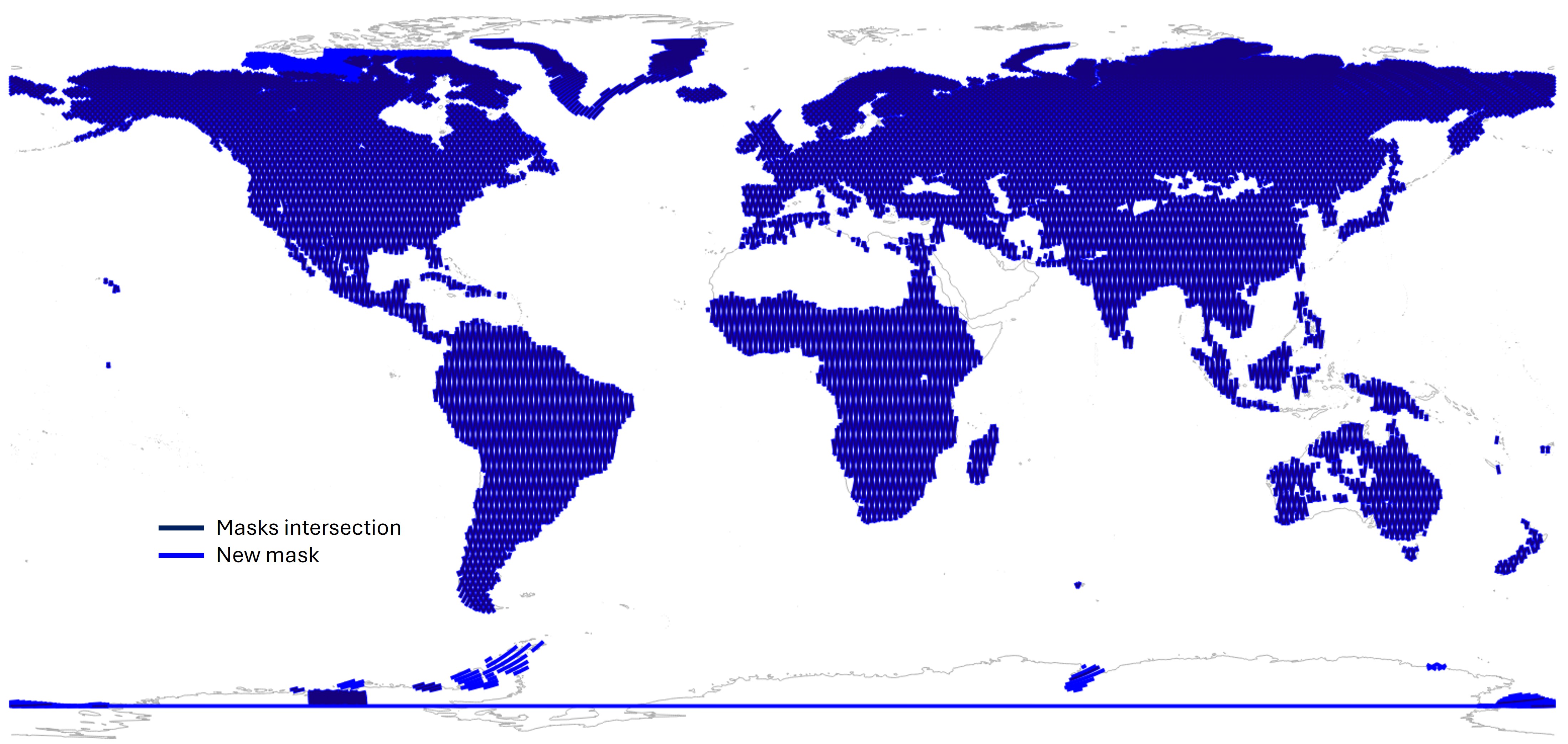
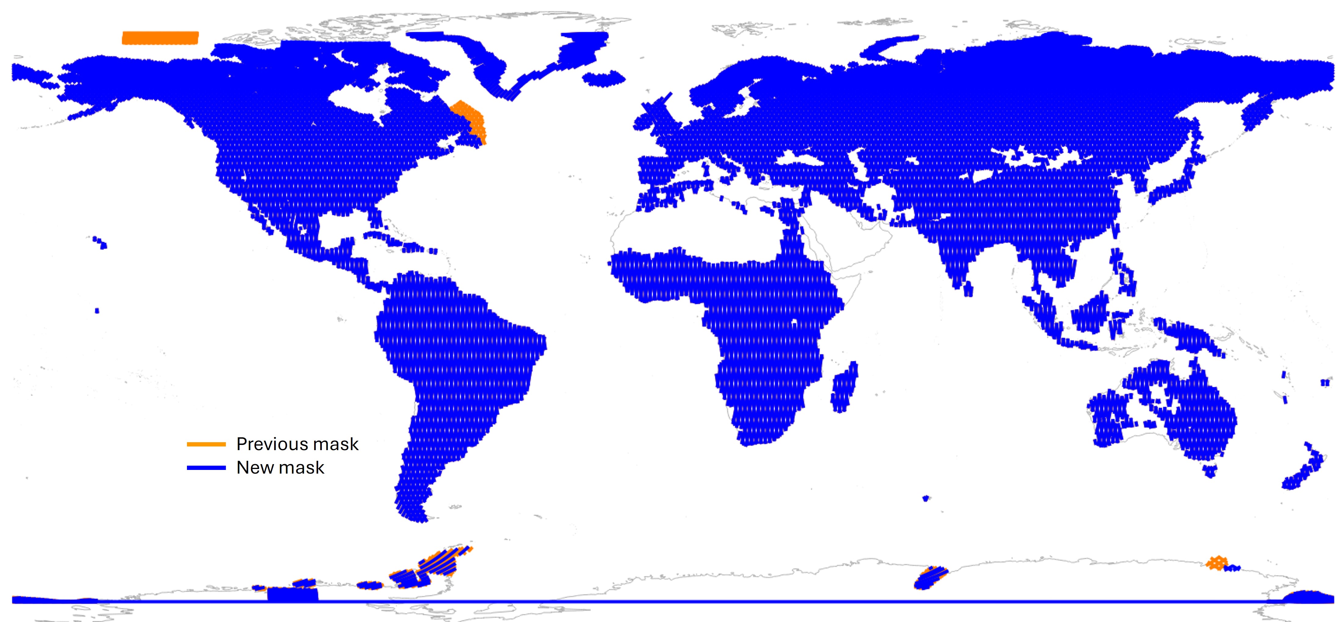
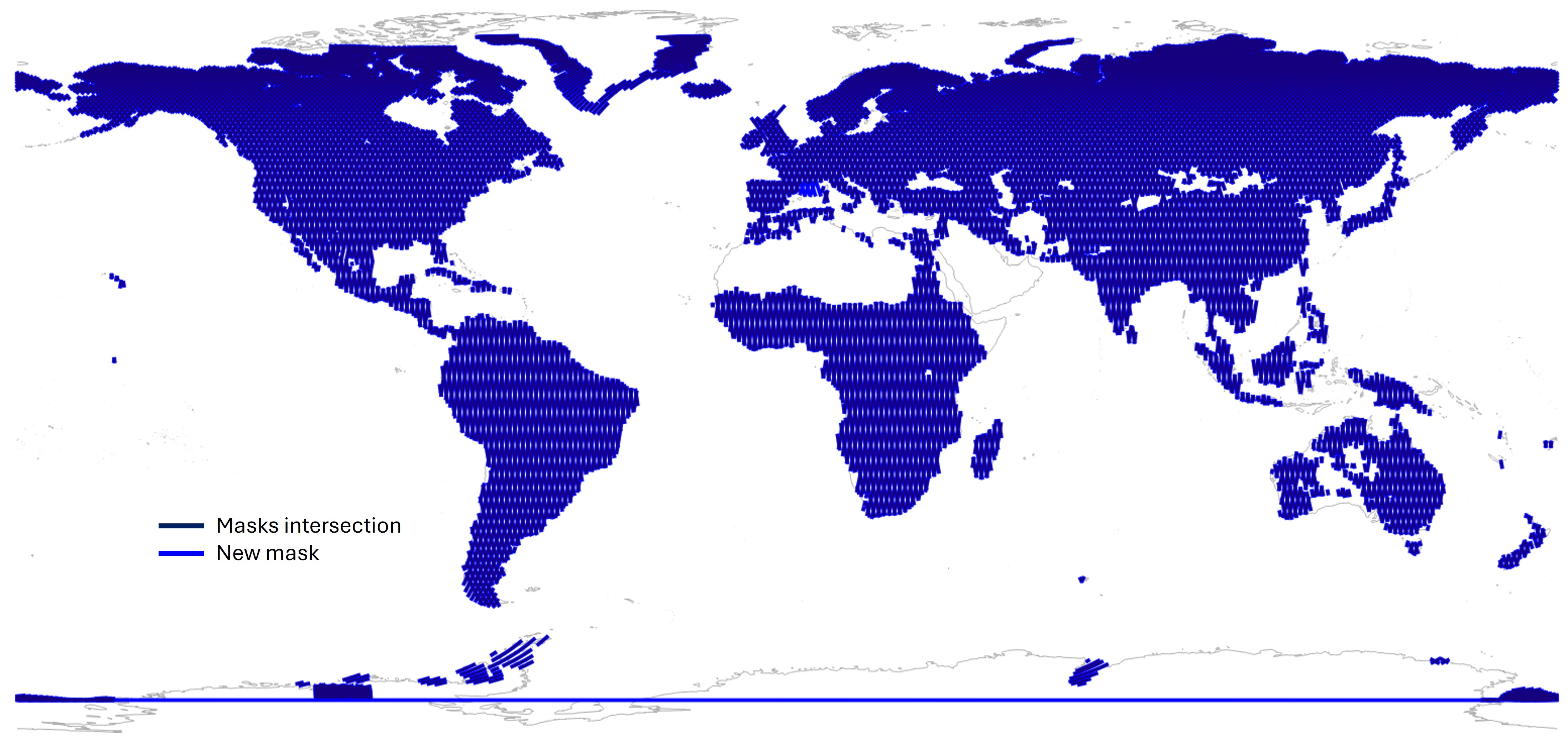
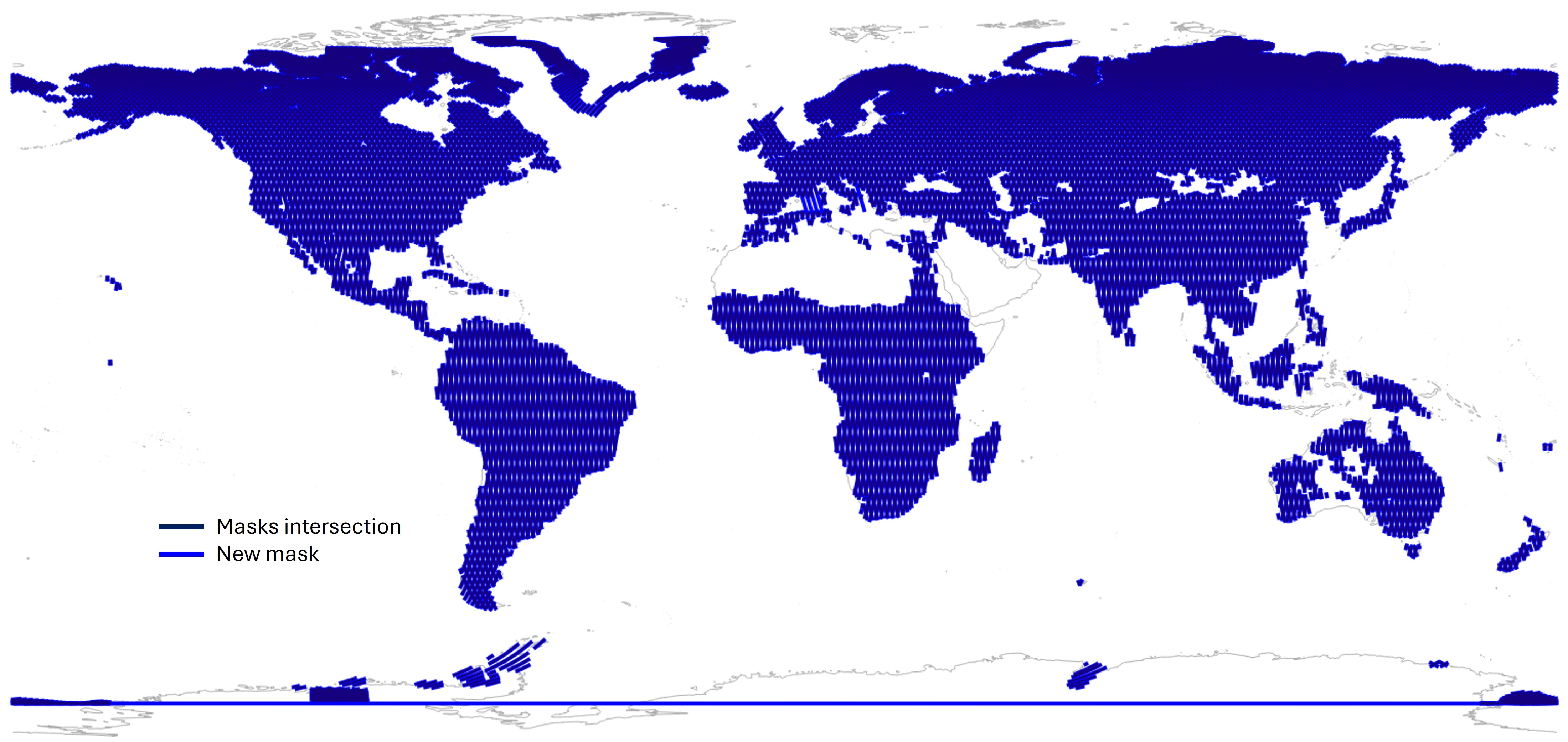
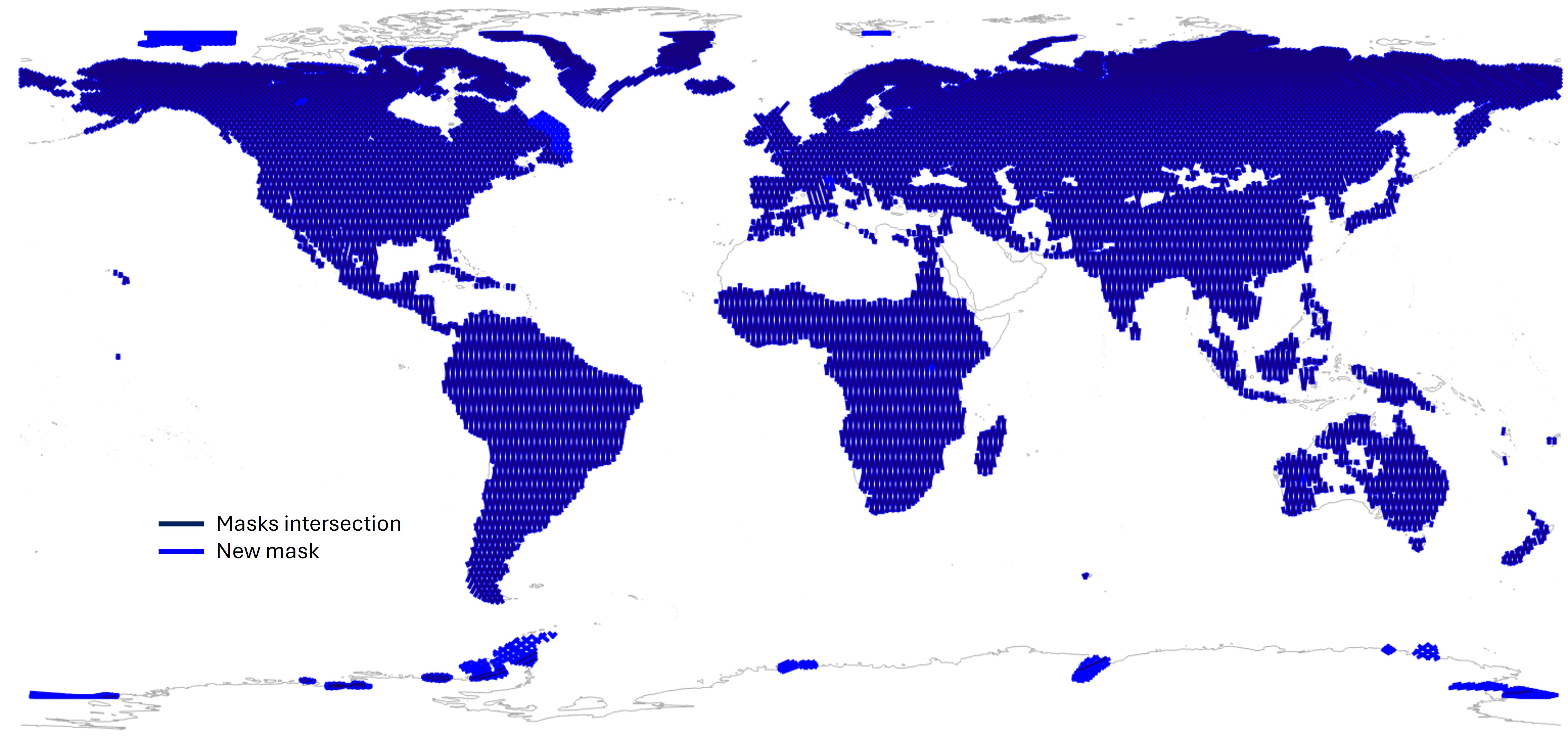
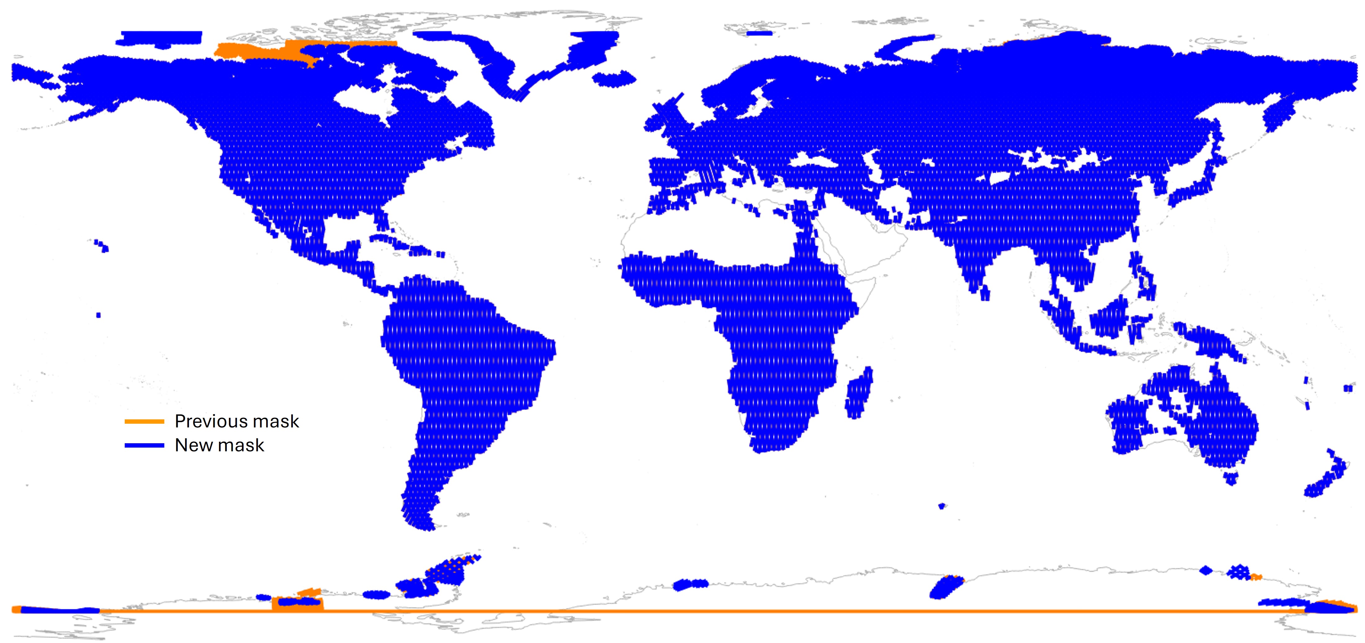
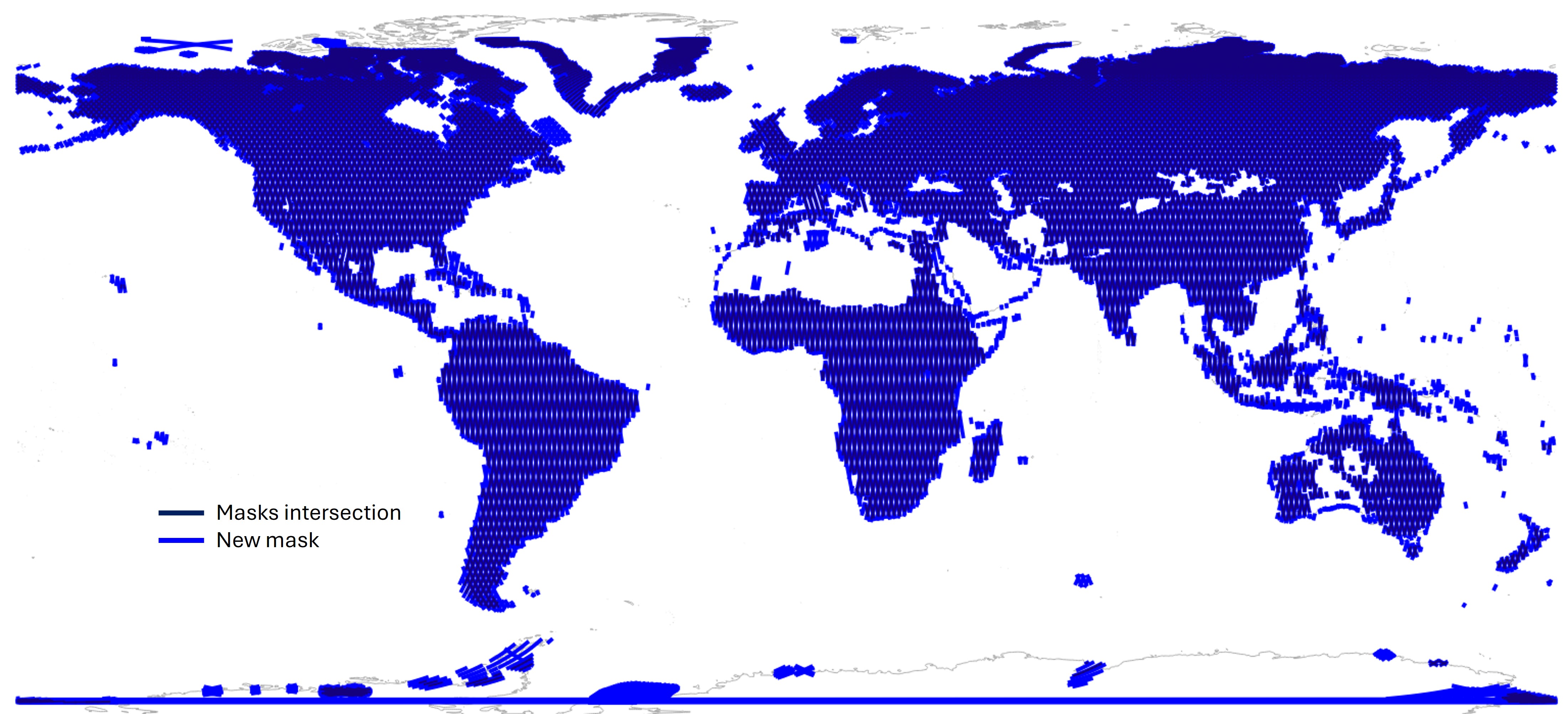
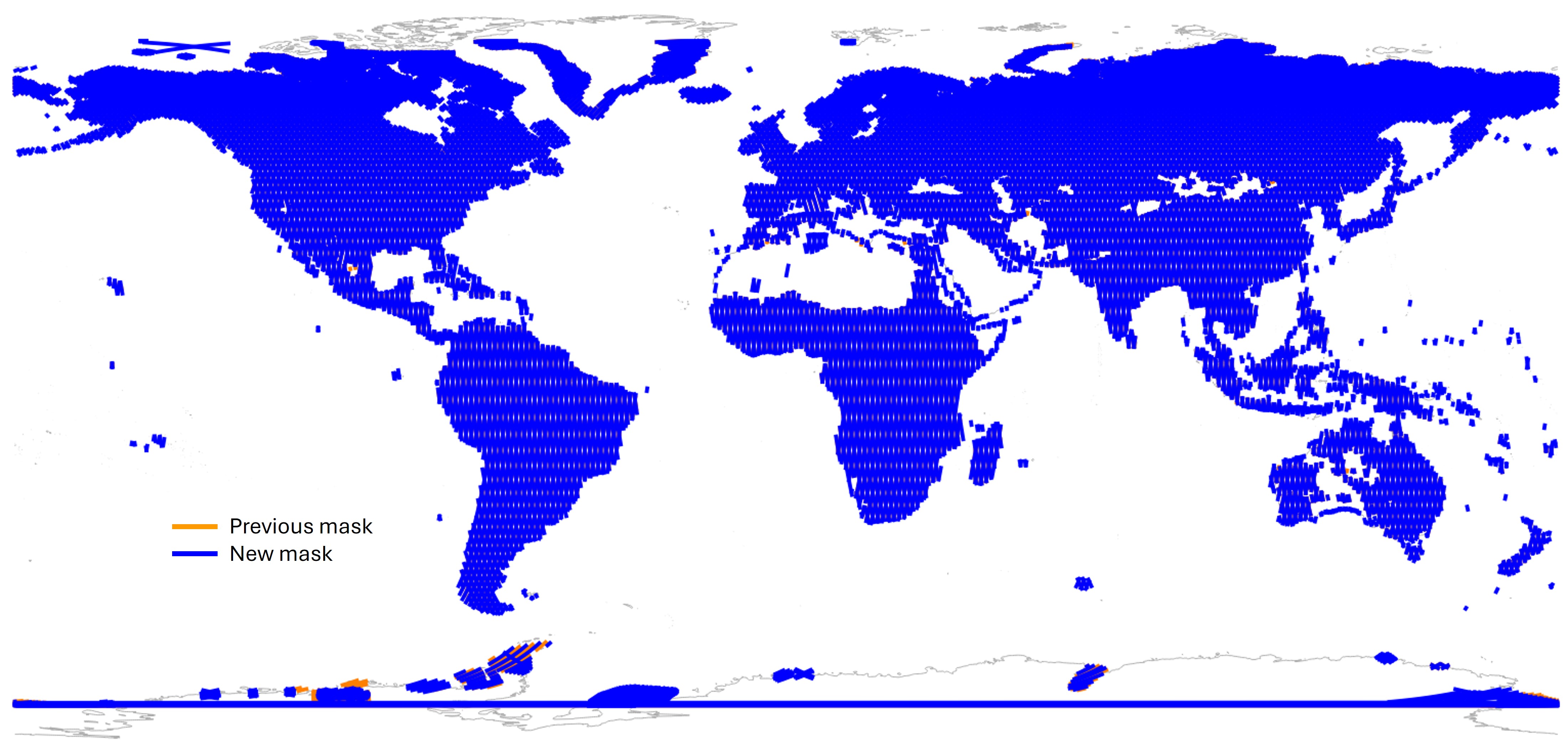
On this platform, you can find, visualize, plot and download the full set of Level-2 High Rate (L2 HR) collections focusing on continental surfaces. The High Rate (HR) mask gathers all earth regions where the SWOT High-Rate processings are applied. This mask is seasonnaly updated following SWOT Science Team recommendations to monitor new regions or scene of particular scientific interest. For example:
When downloading a given seasonnal HR mask, you will simultaneously get a pass-based KML file, a swath-based shapefile and a nadir-focused shapefile. You can also visualize on the platform map the swath-based shapefile. In each file, the following attributes are available:
Complete timeline of SWOT HR masks evolution:
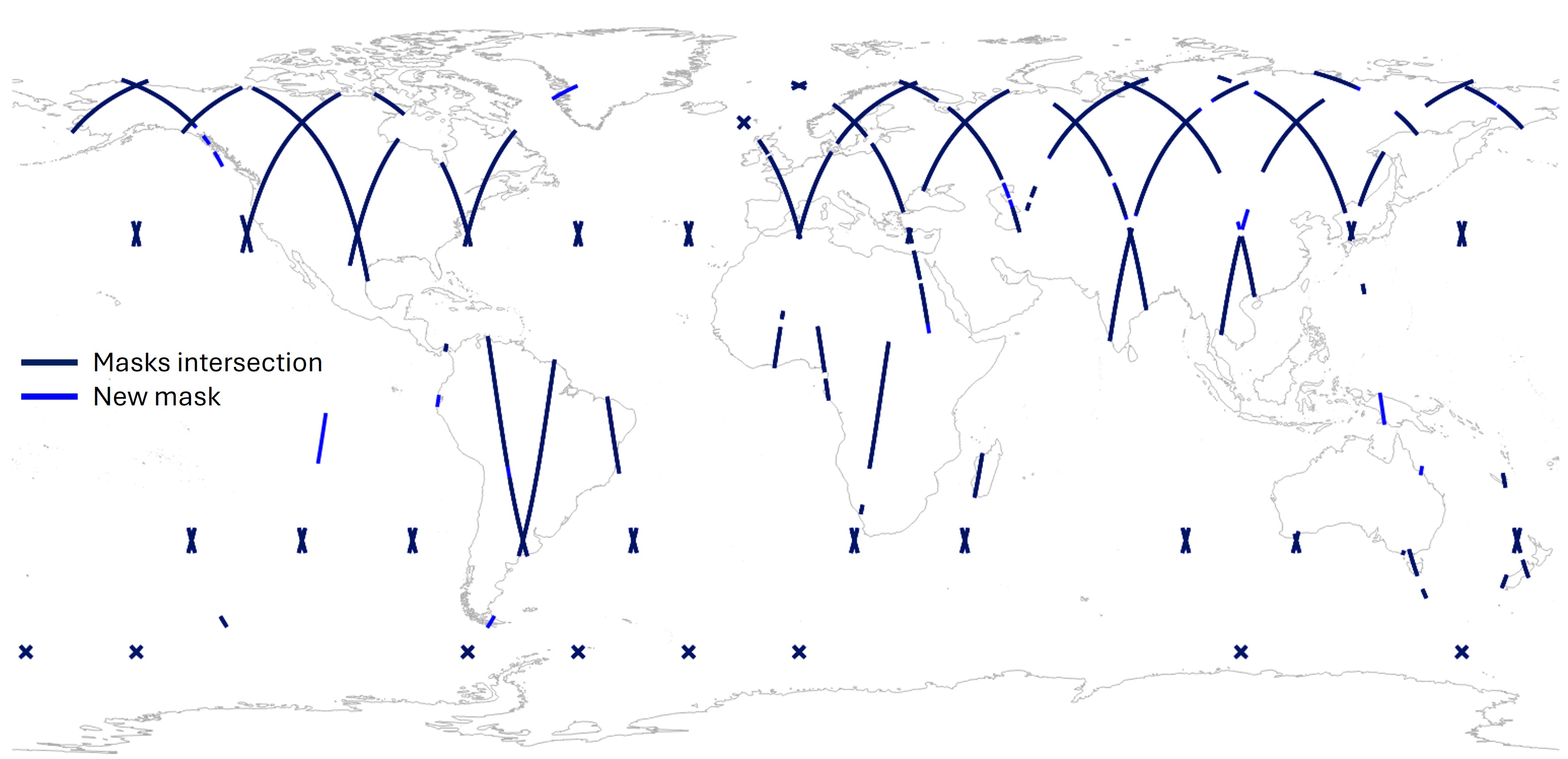
| Start Time (UTC) | Start Cycle | Start Pass | Description | HR Mask name | Insertion map | Withdrawal map |
|---|---|---|---|---|---|---|
| 2023-04-05 T20:16:13 | 481 | 28 | Activate v04c at launch calibration orbit high-rate mask | swot_calval_ hr_2.0s_4.0s_Oct2021-v04c | - | - |
| 2023-04-07 T13:17:13 | 483 | 20 | Activate v07 nominal calibration orbit high-rate mask | swot_calval_ hr_Dec2022-v07 | Map | Map |
| 2023-07-11 T00:00:13 | 578 | 22 | No high-rate data during transition to Science orbit | - | - | - |
| 2023-07-26 T11:37:56 | 1 | 148 | Activate v05 nominal northern hemisphere summer high-rate mask | swot_science_ hr_2.0s_4.0s_Aug2021-v5 | - | - |
| 2023-08-11 T13:51:54 | 2 | 14 | Emergency significantly reduced high rate mask for high priority calibration sites only, due to wildfires affecting Inuvik ground station | - | - | - |
| 2023-08-21 T12:01:36 | 2 | 292 | Activate v06b off-nominal high-rate mask. 44% of nominal coverage due to wildfires affecting Inuvik ground station | swot_science_ hr_Aug2023-v6b | Map | Map |
You will also find details on SWOT HR mask changes on the following website: https://podaac.jpl.nasa.gov/SWOT-events/SWOT_events.html
Not applicable
Not applicable
Vector (polygons)
Shapefile
Composite
SWOT_SEASONAL_HRMASK
latest
| 2023-08-25 T21:35:34 | 2 | 415 | Activate v06c off-nominal high-rate mask. 44% of nominal coverage due to wildfires affecting Inuvik ground station | swot_science_ hr_Aug2023-v6c | Map | - |
| 2023-09-14 T23:59:31 | 3 | 393 | Activate v05 nominal northern hemisphere summer high-rate mask | swot_science_ hr_2.0s_4.0s_Aug2021-v5 | Map | Map |
| 2023-11-30 T23:58:35 | 7 | 213 | Activate v05 nominal northern hemisphere winter high-rate mask | swot_science_ hr_Dec2021-v05-seasonal | Map | Map |
| 2024-02-29 T23:57:46 | 11 | 424 | Activate v05 nominal northern hemisphere summer high-rate mask | swot_science_ hr_2.0s_4.0s_Aug2021-v5 | - | - |
| 2024-03-19 T14:12:28 | 12 | 360 | Activate v06c off-nominal high-rate mask. 44% of nominal coverage due to cut internet cables affecting Hartebeesthoek downlink station | swot_science_ hr_Aug2023-v6c | - | - |
| 2024-03-21 T13:12:11 | 12 | 415 | Activate v07 off-nominal high-rate mask. 76% of nominal coverage due to cut internet cables affecting Hartebeesthoek downlink station | swot_science_ hr_Mar2024-v7 | Map | Map |
| 2024-04-19 T14:07:09 | 14 | 60 | Activate v07b off-nominal high-rate mask. 76% of nominal coverage due to cut internet cables affecting Hartebeesthoek downlink station | swot_science_ hr_Apr2024-v7b | Map | Map |
| 2024-04-30 T13:39:09 | 14 | 367 | Activate v05 nominal northern hemisphere summer high-rate mask | swot_science_ hr_2.0s_4.0s_Aug2021-v5 | Map | Map |
| 2024-08-20 T15:16:17 | 19 | 584 | Activate v07b off-nominal high-rate mask. 76% of nominal coverage due to equipment issues at Hartebeesthoek downlink station | swot_science_ hr_Apr2024-v7b | - | - |
| 2024-09-04 T13:31:29 | 20 | 418 | Activate v08 off-nominal high-rate mask. 90% of nominal coverage due to equipment issues at Hartebeesthoek downlink station | swot_science_ hr_Aug2024-v8 | Map | Map |
| 2024-09-09 T13:41:33 | 20 | 558 | Activate v05 nominal northern hemisphere summer high-rate mask. | swot_science_ hr_2.0s_4.0s_Aug2021-v5 | Map | - |
| 2024-11-23 T00:00:00 | 24 | 305 | Activate v09 northern hemisphere winter high-rate mask | swot_science_ hr_Nov2024-v09-seasonal | Map | Map |
| 2025-02-27 T13:16:31 | 29 | 88 | Activate v09 nominal northern hemisphere summer high-rate mask | swot_science_ hr_Feb2025-v09-nominal | Map | Map |
| 2025-04-05 T20:01:27 | 30 | 547 | Activate v10 nominal northern hemisphere summer high-rate mask with addition of small area in Mediterranean Sea | swot_science_ hr_Mar2025-v10 | Map | - |
| 2025-04-24 T14:01:33 | 31 | 488 | Activate v10b nominal northern hemisphere summer high-rate mask with addition of two small areas in Mediterranean Sea | swot_science_ hr_Apr2025-v10b | Map | - |
| 2025-10-31 T12:19:25 | 40 | 548 | Activate v11S modified northern hemisphere winter high-rate mask | swot_science_ hr_Oct2025-v11S | Map | Map |
| 2026-02-27 T14:00:00 | 46 | 377 | Activate v10b nominal northern hemisphere summer high-rate mask with addition of two small areas in Mediterranean Sea | swot_science_ hr_Apr2025-v10b | - | - |
| 2026-03-24 T15:00:00 | 47 | 494 | Activate v12 nominal northern hemisphere summer high-rate mask with addition of oceans within 30 km of land | swot_science_ hr_Feb2026-v12 | Map | Map |